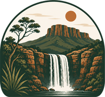
Also spelled Catuá. The gem of the village of Campo Alegre (Mocambo/Mucambo district), in Paranã (TO), on the disputed GO–TO border strip north of Cavalcante. Guides say the drop is ~70 m; the state tourism registry lists 101 m. A tall fall set into a rock wall, whose great distinction is two pools side by side: one of cold emerald-green water fed by the waterfall, and another of warm turquoise-blue water welling up from a spring in the rock. An isolated place with no facilities, visitable only with an accredited guide.
Ready-made itineraries
Not sure where to start?
Day-by-day 3, 5 and 7-day itineraries, grouped by proximity — with distances, trails and the best time to go.
3 days
The essentials in a long weekend: Vale da Lua, the National Park and the waterfalls around Alto Paraíso.
View itinerary5 days
The classic Chapada: the National Park and Alto Paraíso's waterfalls, plus the trip north to the turquoise waters of Cavalcante and the Kalunga territory.
View itinerary7 days
The whole Chapada, unrushed: the National Park, the Segredo reserve, the Alto Paraíso cluster and three days in the turquoise north of Cavalcante and the Kalunga territory.
View itinerary
On the map and in the list
Waterfalls, caves and viewpoints
Filter by trail, road, season and the real driving distance from each base town.
Complexo de várias quedas e piscinas no Rio dos Couros, com quedas de até ~100 m e uma 'borda infinita' debruçada sobre o vale, dentro do Parque Estadual de Alto Paraíso (PEAP). Entrada gratuita — no estacionamento pede-se contribuição voluntária. Pela regra da Semad, o acesso é em grupos de até 6 pessoas acompanhados de condutor local.
The Rio da Prata complex: clear water, pools for swimming, and far fewer people. The local pick when someone asks for 'the truly most beautiful one'.
A free fall of about 115 m (some sources say 120 m) on the Simão Correia stream, a tributary of the Rio São Bartolomeu, in the rural area east of Alto Paraíso de Goiás — an area recently added to the National Park's expanded bounds. Access is via ~33 km of dirt road (GO-239 toward Nova Roma) and a ~12 km round-trip trail that starts by crossing the Rio São Bartolomeu, with crystal-clear pools and a secondary waterfall with a deep pool along the way. Open daily 7am to 6pm, with entry allowed only until 11am.
One of the wildest itineraries in the Chapada, in the Rio Macacão valley, between Alto Paraíso and São João d'Aliança: the Cachoeira da Escadaria and the Macacão/Catedral, with a drop of at most ~40 m. An area where maned wolf and pampas deer are often sighted; the base is the Aldeia Macaco.
A series of natural pools and rock slides in warm-ish water among the cerrado. A playful spot, great for a full day with the family.
On the map
The whole Chapada on one map
Every attraction with a real pin, the distance from each base town and the year-round water timeline.
118 attractions on the mapOpen the full-screen mapOnly on Atlas
5,000+ waterfalls that don't have a name yet
An algorithm swept the Chapada's terrain and flagged thousands of candidate waterfalls — no name, no trail, waiting for whoever gets there first.
See the hidden waterfallsExplore and check off
How much of the Chapada have you explored?
Mark the waterfalls you've visited, track your progress and climb the Chapada explorers' ranking.
See the rankingAfter sunset
The starriest sky in the cerrado
Truly dark skies and astronomy tours at the Bellatrix Observatory — the Chapada is a stargazing destination too.
See the sky map


