
Foto: Adelano Lázaro · CC BY-SA 4.0 · commons.wikimedia.org
More photos on GoogleCachoeira Ponte de Pedra
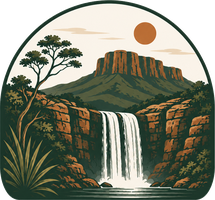
A waterfall that passes through a natural stone arch, at Reserva Renascer in Cavalcante (access via the dirt road from Cavalcante toward Colinas do Sul, at KM 9). A rock formation about 30 m high and 1.8 billion years old — one of the oldest spots in the Chapada, a true open-air museum. The Rio São Domingos runs through the arch; about 100 m below, the canyon opens up, with an infinity-edge waterfall of roughly 70 m and two lookouts (views of the Catingueiro and of the Ponte de Pedra itself). There's a stretch you drive to the parking area before setting foot on the trail.
- Tour guide required, arranged through Reserva Renascer.
- Entry 8am–1pm, return by 4pm — every day.
- CAT Cavalcante — (62) 3494-1507 · turismo.cavalcante.go.gov.br
How to get there
- From Cavalcante9 km
- From Teresina de Goiás30 km
Via the dirt road from Cavalcante toward Colinas do Sul, at KM 9, you enter Reserva Renascer and drive another ~3 km to the parking area where the trail begins. A regular car can make it — the reserve is improving the rough stretches of road.
The route leads to the parking area, where the trail begins — the map pin marks the attraction itself, a short walk from there.
The trail
A 6 km round-trip trail (~2h on foot), moderate to strenuous. The drive within the farm to the parking area (~6 km round trip) is separate.
The water & the river
- River
- Rio São Domingos
Ratings
Scored 1 to 5. Beauty is subjective — so we split it into axes, letting you sort by what matters to you.
Planning your visit
Cachoeira Ponte de Pedra is about 9 km by road from Cavalcante; access is by a well-kept dirt road; the trail is 6 km round trip, moderate level, around 2 h.
The visit requires a local guide: tour guide required, arranged through Reserva Renascer; entry costs R$ 50 per person.
- Do I need a guide?
- Tour guide required, arranged through Reserva Renascer.
- How much is entry?
- R$ 50 per person.
- Can I go in a regular car?
- Yes, with care — well-kept dirt road.
- What are the hours?
- Entry 8am–1pm, return by 4pm — every day.
Guides for this waterfall
This visit requires an authorised guide. Message them directly — the text is ready to send.
- Daniel Maia — Território Kalunga, cachoeiras, fotografia com droneWhatsApp
- Mercides — quilombo Kalunga, trilhas, Engenho IIWhatsApp
- Guias Kalunga — Complexo Turístico (AKCE) — quilombo Kalunga, Santa Bárbara, Candaru, CapivaraWhatsApp
How did the Ponte de Pedra form?
- 1
The ancient basement (over 2.1 billion years)
- More than 2.1 billion years ago the region's oldest rocks formed: the schists and gneisses of the Ticunzal Formation — whose type area is right here in Cavalcante.
- Between 2.15 and 2.0 billion years ago, great masses of granite (Aurumina Suite) intruded those old rocks.
- That granite-and-gneiss basement is what crops out today in the valley below the falls and around town.
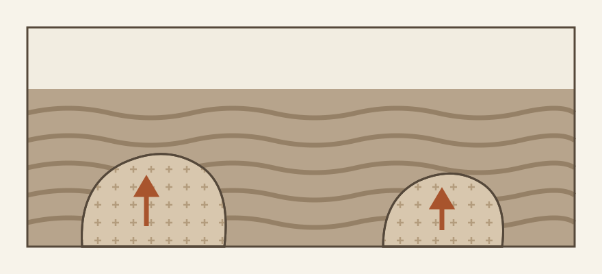
- 2
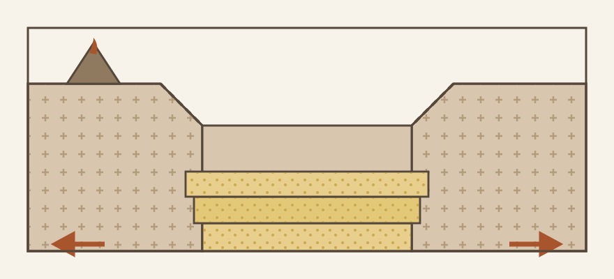
A rift opens and fills with sand (~1.77 billion years)
- Around 1.8–1.6 billion years ago the crust stretched and broke, opening a rift — a long, deep valley — with volcanoes active around 1.77 billion years ago.
- Rivers, gravel fans and wind-blown dunes filled that valley with sand and pebbles: the sediments of the Arraias Formation, Araí Group.
- That is the unit where the Geological Survey of Brazil's map places the Ponte de Pedra area — right at the edge where the rift cover meets the old basement.
- 3
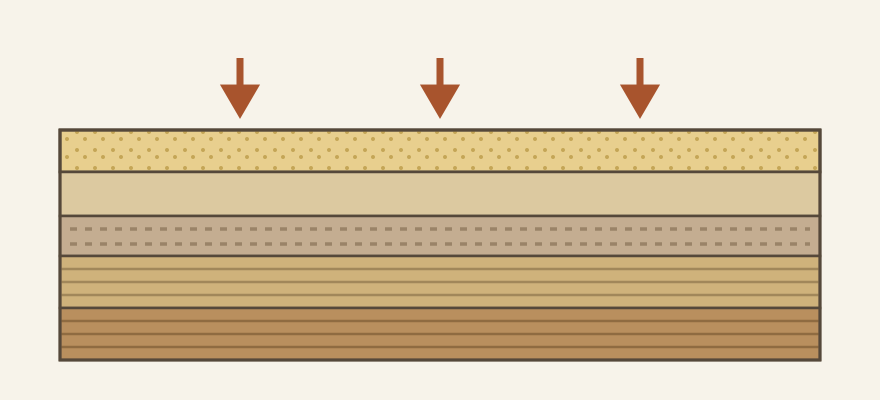
Sand turns to hard rock
- Buried under new layers of sediment, the rift sands were compacted and cemented into hard sandstone.
- The final transformation into quartzite — quartz grains welded together, one of the most erosion-resistant rocks there is — probably came with the heat and squeeze of the continental collision in the next step.
- Not every layer ended up equal: in the region, pure hard quartzites alternate with more micaceous, crumbly layers — a difference that will matter later.
- 4
Continents collide: folds and fractures (~600 million years)
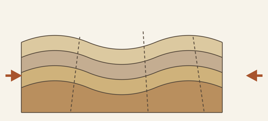
- About 600 million years ago, the continental collision that built the Brasília Belt folded and fractured the rocks across the whole region.
- In Cavalcante those folds are giants — one is visible at the Mirante da Nova Aurora, near here.
- The fractures opened back then became the preferred paths where water would go to work.
- 5
The plateau rises and the river plunges
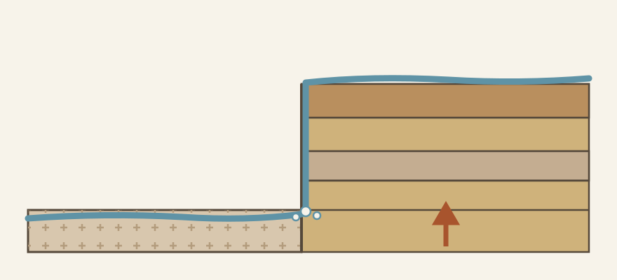
- Much later the region was uplifted and erosion stripped the softer layers, leaving hard quartzite holding up the highlands.
- Around Ponte de Pedra, the São Domingos river drops nearly 500 metres from the plateau rim to the valley floor within a few kilometres (elevation-model estimate).
- It is on that raised rim of hard quartzite that the river makes the great leap of the waterfall — 70 to 100 m depending on the source; further down, the valley already runs over the basement granites and gneisses.
- 6
And the arch? The classic stone-bridge process
- We found no published geological study of this specific arch — the closest description, from a travel account, says it was “opened by the slow, patient work of the waters” of the river.
- In stone bridges like this one, water tends to find its way through weaker layers or fractures beneath a hard quartzite bed, widening the passage little by little until the whole river flows underneath — leaving the resistant layer suspended as a bridge, here with a span of nearly 30 metres according to the local operator.
- The rock is about 1.8 billion years old, but the bridge itself is a young, fleeting landform: like every natural bridge, one day it will thin out and collapse.
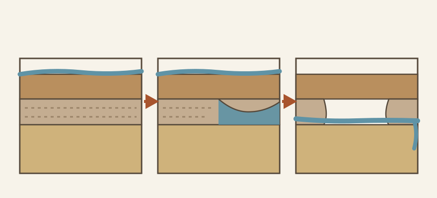
Ponte de Pedra is carved in quartzites of the Arraias Formation (Araí Group, ~1.8 billion years), laid down in an ancient rift over even older granites and gneisses — the same ones cropping out in the valley below. Uplift and erosion left the hard quartzite holding the plateau while the São Domingos river plunges off the rim; the arch is a young landform, probably opened by water exploiting weak layers and fractures beneath the resistant rock — the classic stone-bridge process.
Enjoy mindfully · Don't remove rocks or plants · Respect nature
Nearby
Other attractions close by, as the crow flies — good candidates for the same day.


FPV video coming soon
Drone footage of this waterfall.
Avaliações
Carregando…