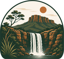
The tallest fall in the Chapada — about 187 m, at Reserva Bellatrix in São João d'Aliança. Few people know it; those who go don't forget it.
Themed route
Escape the crowds
For those after some quiet: only the waterfalls with a high solitude score (4+), far from the packed itineraries.
49 attractions on this route — refine with the filter below.
A tall, powerful drop (≈70 m) hidden in the Kalunga. A moderate trail and few visitors — one of the best-kept secrets in the northern Chapada.
The peak of adventure in the Chapada: falls of ~90–97 m plunging into the region's largest canyon, with ~100 m walls. Getting there is an expedition — a heavy trail and ~3 km of aquatic traverse in wetsuit, helmet, and life vest inside the Rio Macaquinhos canyon, at Reserva Piraquara (São João d'Aliança). Open to visitors since 2018.
A gorge where the entire Rio Paranã is squeezed between rock walls and becomes class III–IV rapids — the 'Funil' — within Kalunga land. The way to experience it is an ethnocultural rafting trip down the river with Kalunga guides, dry season only (the day trip departs from Alto Paraíso, not Cavalcante). Note a common mix-up: this Rio Paranã belongs to the Tocantins-Araguaia basin (a Tocantins tributary), not the Rio Paraná of the south. And the river-dolphin story: residents report a river dolphin on this stretch. If real, it would be of the genus Inia — probably the Araguaian dolphin (Inia araguaiaensis, only described in 2014, considered Brazil's only endemic river dolphin). But in fairness: there's no scientific or press record of a dolphin on the Rio Paranã itself (the known isolated population is in the neighboring Rio Maranhão basin), so it's an unconfirmed local account — not a 'new species discovered here' — and a sighting, when it happens, is pure luck.
The "Complexo das Lajes" doesn't exist as a separately cataloged attraction: the name refers to the Córrego das Lajes and Fazenda Lages, on the GO/TO border, which together with the Córrego Canjica form the well-known Complexo Águas Lindas e Canjica. It's a set of waterfalls, canyons, and infinity-edge pools set into rock slabs, with turquoise and emerald water. It sits on Kalunga land, about 75 km from Cavalcante by dirt road, with a guide required.
One of the richest caves in Brazil for speleothems, inside the Parque Estadual de Terra Ronca, with over 20 km of passages and the Rio São Mateus running through it. The original entrance collapsed millennia ago, so you enter through a narrow, steep fissure, descending about 5 m on a rope. Inside, monumental chambers open up — such as the Salão dos Travertinos Gigantes, the Salão das Agulhas, and the Salão das Pérolas — lined with white stalactites, calcite flowers, and multicolored travertine pools.
The most extreme of the Parque Estadual de Terra Ronca caves: entry is by a vertical rappel of about 40 m, and inside the Rio São Vicente forms a rare sequence of underground waterfalls. It's at São Vicente that the famous "blue ray" occurs — a beam of light entering through a gap in the ceiling around 1pm and taking on a bluish tone from the cave's humidity. The cave is closed to ordinary visits; only with Semad authorization and an accredited guide.
A private waterfall complex on the Rio Caldeira, ~19 km from Alto Paraíso via the GO-239 toward the village of Sertão, with four falls in a row: Caracol, Pedrão, and Walkyrias 1 and 2, all with swimming pools. The Cachoeira do Caracol, the last and tallest on the route, falls through a fissure in the rock forming a veil in front of a spiral wall — the final access is by via ferrata (a metal ladder fixed to the rock) with a harness and helmet provided, in groups of up to 6 visitors plus the guide; under-10s can't go up. The visit requires booking and an accredited guide — it's forbidden to enter the complex without a guide. An easy ~2.5 km (round-trip) trail along the river, with shaded forest stretches.
Also spelled Catuá. The gem of the village of Campo Alegre (Mocambo/Mucambo district), in Paranã (TO), on the disputed GO–TO border strip north of Cavalcante. Guides say the drop is ~70 m; the state tourism registry lists 101 m. A tall fall set into a rock wall, whose great distinction is two pools side by side: one of cold emerald-green water fed by the waterfall, and another of warm turquoise-blue water welling up from a spring in the rock. An isolated place with no facilities, visitable only with an accredited guide.
A free fall of about 115 m (some sources say 120 m) on the Simão Correia stream, a tributary of the Rio São Bartolomeu, in the rural area east of Alto Paraíso de Goiás — an area recently added to the National Park's expanded bounds. Access is via ~33 km of dirt road (GO-239 toward Nova Roma) and a ~12 km round-trip trail that starts by crossing the Rio São Bartolomeu, with crystal-clear pools and a secondary waterfall with a deep pool along the way. Open daily 7am to 6pm, with entry allowed only until 11am.
The Rio da Prata complex: clear water, pools for swimming, and far fewer people. The local pick when someone asks for 'the truly most beautiful one'.
One of the wildest itineraries in the Chapada, in the Rio Macacão valley, between Alto Paraíso and São João d'Aliança: the Cachoeira da Escadaria and the Macacão/Catedral, with a drop of at most ~40 m. An area where maned wolf and pampas deer are often sighted; the base is the Aldeia Macaco.
A little-explored waterfall in the Vão do Moleque, on Kalunga land, in the same Rio Curriola water system as its neighbor the Cachoeira do Guardião — but it's a distinct fall, listed separately in the Vão do Moleque community-based tourism. The water comes down a narrow wall into a pool of intense, crystal-clear blue-green, ringed by forest. Access is far shorter and easier than the Guardião's: about 2 km of trail (round trip), with the option to continue ~4 km upriver to additional natural pools.
The main traverse of the Parque Nacional da Chapada dos Veadeiros: about 23.5 km over 2–3 days, with an overnight at the rustic camping by the Rio Preto, next to the set of small falls and pools that gives the place its name. The route leaves from the Visitor Center in São Jorge, crosses rocky highland fields and cerrado streams, and ends at a gate on the GO-239, ~12 km from São Jorge. It only runs in the dry season (2026 season: 15 Jun to 11 Oct), with the overnight booked in advance on the park's official site and a mandatory briefing at entry.
One of the most unexplored waterfalls in the Chapada, hidden in the Vão do Moleque, within Kalunga land. The fall plunges off an imposing wall into a pool of crystal-blue water up to 12 m deep, with a natural rock diving platform. Almost the entire trail runs along the bed of the Rio Curriola, over rocks, inside the canyon. A Kalunga community-based tourism attraction, open to visitors since 2018.
The cerrado's "cenote": a flooded vertical shaft of turquoise-blue water within the Terra Ronca complex, famous for never having had its bottom reached — divers have passed 50 m and estimates put it around 180 m deep. The descent is by a rappel of some 45 m straight down to the water's surface, inside a fissure in the limestone. It's on private property, about 14 km from Divinópolis de Goiás, and can only be visited with an authorized agency.
The ≈80 m drop of the Rio Preto inside the National Park — the second big fall on the Saltos trail, just below Salto I (120 m). An imposing wall and a pool for swimming at the base when the river level allows.
One of the tallest falls in the region, with the Rio Ave Maria plunging about 120 m into a canyon, on Kalunga land some 12–14 km from Cavalcante, on the way to Santa Bárbara. It's a single attraction with two viewpoints: the view from above, from the lookout on the Serra da Nova Aurora, reached by a short, easy trail after driving nearly to the start; and the view from below, at the base of the waterfall, via a longer trail with wooden walkways and railings, restricted and scheduled access. At the peak of the rains the wall fills up; in the dry season the flow drops sharply.


